
Benbrook Neighbors Block Sources
A block is smaller than a ZIP code or subdivision. For Benbrook neighbors, it means the parcels immediately around a target address. Tarrant County's CAID map establishes the parcel pattern. TAD supplies the current assessment card. County plats and deeds confirm legal relationships. Tarrant voter tools can help confirm a known person's registration under state rules, while the City resource directory supplies association contacts. Each source answers a different question, and none creates a complete private household list.
| Block source | What it shows about nearby parcels | Access |
|---|---|---|
| Tarrant CAID | Parcel boundaries, address, owner or account query, and map layers | Public interactive map, informational only |
| TAD property card | Assessed owner, mailing address, situs, value, legal description, and account context | Public current assessment search |
| County plats and deeds | Lot and block, easements, subdivision layout, and conveyance history | Official index, counter, and historical archives routes |
| Voter lookup or list | Known voter registration or precinct information where law allows | Individual tool or lawful request, with protections |
| City resource directory | Published HOA and neighborhood association contacts | City directory, incomplete membership coverage |
An assessed owner may not be the occupant. A parcel beside a house can be a road right-of-way, a park tract, a school, a common area, or a utility or flood parcel. Start with the legal parcel pattern, not an assumption based on what appears close on a map.
Benbrook Neighbors Parcel Map
The Tarrant County Comprehensive Address Information Directory, known as CAID, searches by address, owner name, or tax account number. For a block search, locate the target parcel, zoom until adjoining parcel lines appear, and turn on the Property layer if needed. CAID also offers City Boundaries, ZIP Codes, voting precincts, schools, flood contours, districts, and other layers. The City notes that GIS boundaries are approximate and layers can switch at particular zoom levels.
Write down each adjoining parcel's situs address, account or georeference, subdivision, and lot or block. Then compare the map with the recorded plat. A shared driveway, drainage easement, or an apparent open gap can look like a neighbor relationship while not being a privately owned adjoining parcel. Benbrook's subdivision process explains that final plats create the legally recorded lots, easements, and rights-of-way.
Note: Use CAID to identify the parcels, then use a recorded plat or deed when an exact legal adjacency matters.
Benbrook Neighbors Owner Cards
Open each mapped account in the Tarrant Appraisal District property search. The observed TAD result layout can provide an account number, georeference, property address, property city, primary owner name, market value, current owner information, primary owner mailing address, legal description, subdivision, neighborhood code, and an instrument reference. The account and legal description are especially useful when a street number does not appear in an older record.
Keep situs and mailing address separate. Situs means the physical parcel. The primary owner address is where the assessor mails notices. A mailing address in Fort Worth, a trust, an LLC, or a management company does not mean that party occupies the parcel. A displayed homestead status is an assessment clue, not an identity certificate. Search the County Clerk's official-record index for the latest deed only after TAD and CAID identify the parcel.
TAD presents current assessment information, not a continuous residence history. Record the search date because owners and values can change. The City permit or code file may add a project date, but it also has separate disclosure limits.
Benbrook Neighbors Association Contacts
Benbrook's City Resource Directory is the local civic layer for a block. It has alphabetized listings, first-letter filters, a category dropdown, a name field, and paginated results. The published neighborhood and HOA entries include Timber Creek, Trail Ridge Estates, Trinity Estates, Trinity Gardens, Waterwood Place, Whitestone Heights, Whitestone Ranch, and Whitestone Ranch Phase 4. These names can help identify the community contact that relates to an address.
The City association-directory capture shows the official resource listing used for this Benbrook neighbors research.
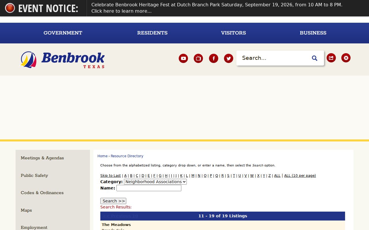
Some published entries use a local contact, while others use a management company or post-office box. The listing is a community contact, not a membership roll or an address map. Check the current City directory before contacting an association because its entries can change.
| Published association group | Use in a block search | Limit |
|---|---|---|
| Timber Creek and Trail Ridge Estates | Find the listed neighborhood contact through the City directory | Does not identify every resident or parcel |
| Trinity Estates and Trinity Gardens | Confirm that an association contact is published | Contact geography may differ from community geography |
| Waterwood Place | Use the current resource entry for HOA context | A PO box is not the physical neighborhood location |
| Whitestone groups | Locate the listed association or management lead | No official complete membership directory was located |
Benbrook Neighbors Voter Boundary
The voter layer is narrower than a parcel map. Tarrant's lookup accepts Voter Unique ID, certificate number, or first name, last name, and address combinations so a known voter can find registration or precinct information. It is not designed to browse every voter on a block. Texas My Voter Portal uses name, county, date of birth, and ZIP for an individual search. Neither tool should be treated as an open neighborhood roster.
Texas Election Code §18.005 describes voter-list fields subject to exceptions, while §13.004 protects Social Security numbers, driver-license numbers, personal ID numbers, and phone numbers. The Address Confidentiality Program and protected-voter rules can suppress an address or a record. Never infer that a nearby parcel has no voter, that every listed voter stays there full time, or that a public display is complete.
Mapping a Benbrook Neighbors Block
Use the map-to-record flow one parcel at a time. This prevents an address search from turning into a bulk dossier and keeps the result tied to real property boundaries. The County Clerk deed index is the next source when a legal description, conveyance, plat, or easement needs confirmation.
- Enter the target address in CAID and zoom to the parcel lines around it.
- Click each visibly adjoining parcel and record its account, situs, subdivision, lot, and block.
- Check the TAD card for assessed owner, mailing address, and legal description, keeping mailing and situs fields distinct.
- Compare the recorded plat and latest deed when a right-of-way, common area, easement, or boundary makes adjacency unclear.
- Use the City association directory only to find a relevant community contact, not to assemble a list of private residents.
For the full chain across a named road, use the Benbrook street directory. That address workflow examines parcel histories along a street, while this neighbors method stays focused on the immediate block.
Benbrook Neighbors Block History
Older blocks need a different scale of research. Pair adjoining lot and block deeds with the subdivision plat, permit records, and code records where releasable. Reverse directories can identify a historical occupant at an address in a published year, and census enumeration districts can add a dated household snapshot. Tarrant Archives and the Fort Worth History Center provide the library and archival routes for directories, maps, school census, newspapers, and historical county material.
Local landmarks can also bridge labels. Benbrook grew around Mary's Creek, rail and road routes, Benbrook Lake, US 377, I-20, Loop 820, and later subdivisions. The 2014 boundary adjustment with Fort Worth means an older address can carry a different municipal label. Match the plat name, lot and block, adjacent parcels, or landmark before assuming that the current city label is the historical one.
Benbrook Neighbors Official Records
Official parcel and deed tools identify the source, date, and legal context of a record. Commercial neighbor tools are private compilations that can merge same-name people, carry stale data, and omit the limits of the original record. The difference matters when a mailing address is mistaken for occupancy or a map boundary is mistaken for legal adjacency.
| Official source | Private compiled tool category | Best use |
|---|---|---|
| CAID, TAD, deed index, City directory | Commercial neighbor search service | Use official records for parcel, ownership, and civic-contact verification |
| Dated record with named custodian | Compiled profile with varied update timing | Compare a match through the custodian and preserve the search date |
| Access rules and redactions are stated | Privacy or correction process varies by provider | Use the lawful minimum detail needed for the question |
A public record is strongest when it is read in its own context. Return to the County Clerk, TAD, City Secretary, Elections office, or association source to correct or confirm a particular record.
Benbrook Neighbors Privacy Limits
Neighbor research should end with parcel relationships, public owner evidence, and community contacts, not a list of private people. Protect addresses covered by the Texas Address Confidentiality Program, voter information covered by Election Code confidentiality rules, and personal identifiers that do not belong in public research. Court, victim, juvenile, and other protected records have their own restrictions. A visible parcel does not authorize repeated contact or surveillance of the people associated with it.
Texas Public Information Act requests can be made to the right Benbrook or Tarrant custodian when a specific releasable record is needed. Describe the address, record type, and date range. Do not request a broad block dossier, and do not treat a missing online result as proof that a person is absent.
The Benbrook City Secretary accepts municipal records requests online, by email, fax, mail, and in person. Police records are routed to the Police Records Division instead. Those channels can be useful for a defined permit, code, agenda, or local court record when the online search is incomplete, but the request remains subject to Texas Public Information Act exceptions and redactions.
Lawful use. Use Benbrook neighbors records for personal, civic, historical, or safety-aware research, never to stalk, harass, intimidate, or harm anyone.